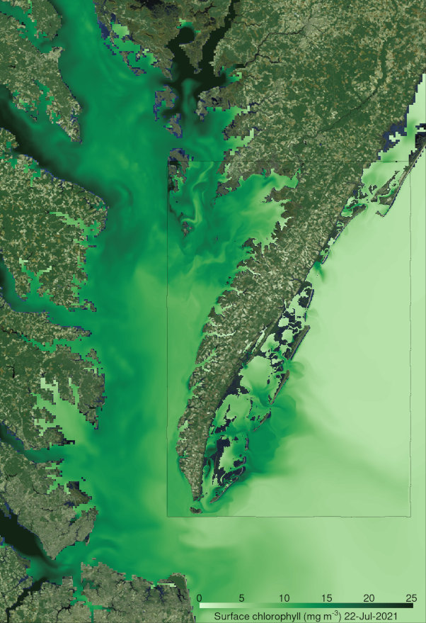
This section is an umbrella for projects (current & past) related to the Chesapeake Bay. The video below features a 600m-resolution implementation of ROMS (St-Laurent 2026; St-Laurent & Friedrichs 2024) that I created with support from MARACOOS and other funding agencies. This Bay-wide 600m implementation provides, in turn, lateral boundary conditions to subdomains of finer resolution representing the different portions of the Bay (nesting).
Figure 1: Virginia portion of the DelMarVa peninsula (rectangle) nested into the Bay-wide model. The color shading represents surface chlorophyll-a concentrations over a few tidal cycles in July 2021. Click on the figure to download a video illustrating different environmental variables.
The Bay-wide model is the basis of the Atlas of physical and biogeochemical conditions in the Chesapeake Bay (updated 29 December 2025).
An archive of daily-averaged outputs is also available and is based on a 1985-2025 hindcast that I conducted on VIMS’ HPC facilities in late 2025/early 2026.
References:
St-Laurent, P., 2026, Water quality impacts during Hurricane Irene (2011) in a large coastal-plain estuary, Estuarine, Coastal and Shelf Science, 329(109632), https://doi.org/10.1016/j.ecss.2025.109632, associated dataset: https://doi.org/10.25773/7mhq-9c49
St-Laurent, P., M.A.M. Friedrichs, 2026, Daily-averaged 3-D model outputs from a hindcast simulation of the Chesapeake Bay (1985-2025) with ROMS-ECB, COMT IOOS, https://par.nsf.gov/biblio/10682128
St-Laurent, P, M.A.M. Friedrichs, 2024, On the sensitivity of coastal hypoxia to its external physical forcings, J. Adv. Model. Earth Syst., 16(1), e2023MS003845, https://doi.org/10.1029/2023MS003845, associated dataset: https://doi.org/10.25773/q2kh-rd09